
Full Text
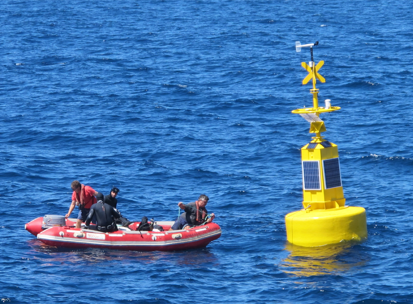
To enhance oceanographic observation capacities in the Atlantic Ocean and the Mediterranean Sea, and under the project “Observation of the Marine Environment with an Operational Oceanographic Observation System,” Morocco’s National Institute of Fisheries Research (INRH) acquired and installed its first meteorological and oceanographic buoy offshore of Dakhla, southern Morocco (Figure 1). This buoy, moored at a fixed point (23°55.1208'N, 16°11.1569'W) on October 7, 2016, is a first experiment conducted by Moroccan scientists and INRH along the Moroccan Atlantic coast. The project’s intent was to allow continuous, real-time acquisition of meteorological and oceanographic data from the South Morocco upwelling area, which is of great scientific, oceanographic, and environmental utility for maritime decision-making, in particular, for the marine fisheries and aquaculture sector in a context of climate change.
|
|
For surface measurements, the buoy carries meteorological instruments, including an anemometer (wind speed and direction) and air temperature and atmospheric pressure sensors. Beneath the surface, the buoy is equipped with a sensor for measuring the wave swell (height, direction, and period); a profiler for measuring the current (speed and direction) in the water column; a multi-parameter sensor that includes water temperature (range 0°–40°C), salinity (0–40 psu), fluorescence, and dissolved oxygen at a single depth level. In addition, the buoy is outfitted with a GPS system for continuous positioning and a complete data acquisition and transmission system.
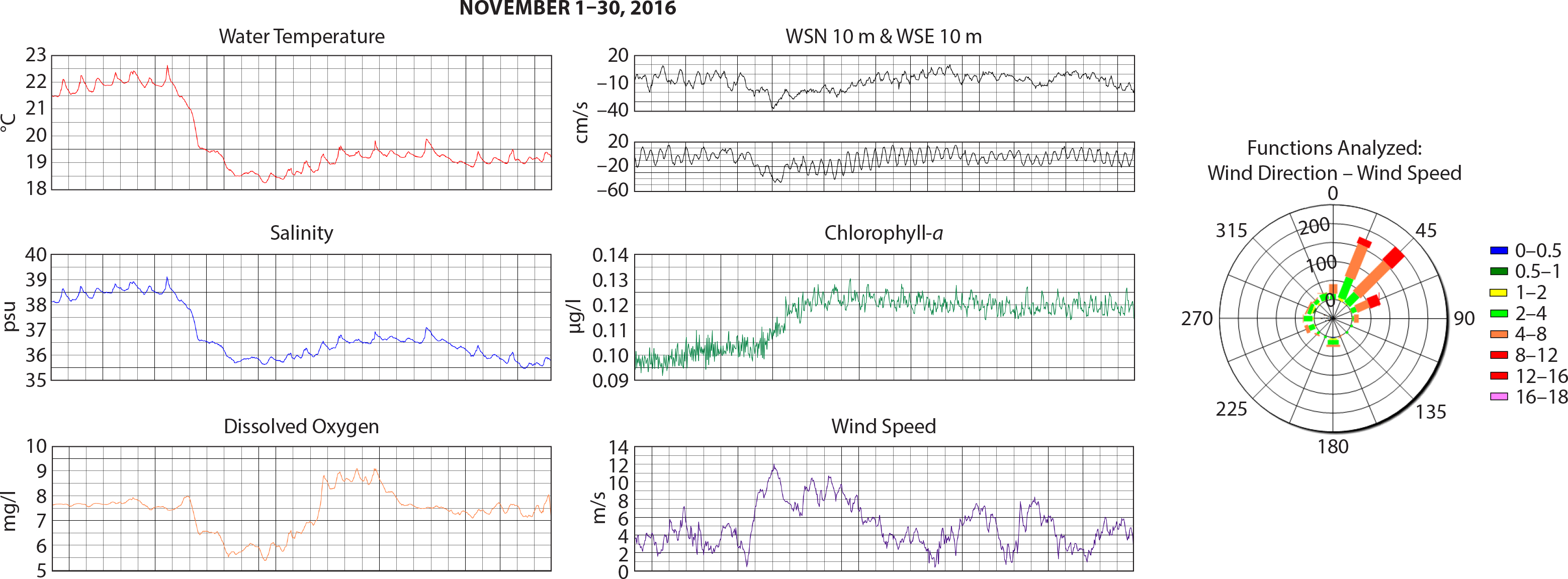
When launched, the buoy recorded and transmitted data to the Laboratory of Physics and Marine Biogeochemistry of the INRH Regional Center in Casablanca. Data processing allowed monitoring of the different parameters every 30 minutes. The results recorded during the month of November 2016 detected the beginning of the upwelling process that brings deep, cold, and nutrient-rich waters to the surface, increasing biological activity and intensifying the current (Figure 2). Surface water temperatures cooled from 22.5°C to 18.5°C on November 10, predicating upwelling during the rest of the month. Salinity followed the same evolution, decreasing from 38.5 psu to 35.6 psu, then stabilizing between 36.5 psu and 37.5 psu. The profile of dissolved oxygen concentration indicates good oxygenation in the area, varying between 8 mg/L and 9 mg/L until upwelling begins, when it starts to decrease below 6 mg/L for three days before returning to concentrations above 7 mg/L for the rest of the month. These conditions were accompanied by phytoplankton enrichment manifested by an increase in the concentration of chlorophyll-a from 0.08 µg/L to close to 0.12 µg/L. The pH was stable at 8 during November. The south to southwest marine current recorded at 10 m depth increased during the period of upwelling activity and reached 35 cm/s for the southern component and more than 40 cm/s for its western component. Maximum intensity was recorded on November 9 just before upwelling began.
|
|
While vandalism five months after buoy deployment has delayed this project coming to fruition, these early data demonstrate that the selected site for the buoy was optimal, recording an important correlation between hydrological and meteorological parameters, especially the change in wind strength and direction, which activates upwelling. It is a constant challenge here, and in other areas of intense fishing activity, to maintain fixed observing assets and keep them safe from vandalism and accidental damage. We are optimistic that when repairs to the buoy are complete and it is redeployed, we will be able to meet our objectives.