Full Text
Vulnerable marine ecosystems (VMEs) are typically identified through detection of indicator taxa and predictive models of their distribution. In the deep sea, analysis of seafloor imagery generates quantitative data that underpin studies of the distribution of VMEs such as cold-water coral communities. The vulnerability of cold-water corals to bottom trawling makes assessment of their distribution and biodiversity a priority for marine spatial management.
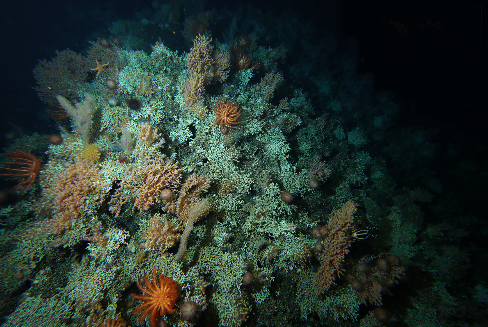
Some of the most diverse and globally significant cold-water coral communities are associated with clusters of seamounts off the coast of Tasmania, several of which are enclosed by two offshore Australian Marine Parks. These extensive reef complexes, located 950–1,350 m below the surface, are dominated by a single coral species, Solenosmilia variabilis, which supports a wide variety of soft corals, sponges, echinoderms, and other invertebrates (Figure 1).
|
|
The seamount fauna in this region has a documented history of ecological damage from a deep-sea bottom trawl fishery. Some areas are still open to fishing, and some have been closed for 20 years. Previous studies have found substantial reductions in coral cover and significantly fewer species of bottom-dwelling organisms on heavily trawled seamounts.
During a 2018 survey aboard R/V Investigator, researchers from Australia's National Science Agency (CSIRO) and from the Australian Government’s National Environmental Science Program (NESP) Biodiversity Hub, together with marine park managers from Parks Australia, collected HD video and still images from seamounts along more than 250 km of seabed, using an advanced, towed underwater camera system developed by CSIRO.
Reviews of collected imagery documented trawling damage on 45 out of a total 51 seamounts, with the most evidence of impact on shallow seamounts (peaks at <950 m depth) where recent and repeated trawling had reduced stony coral reefs to rubble (Williams et al., 2020b). However, many of the seamounts protected by Australian Marine Parks off southern Tasmania displayed few or no signs of impact.
This was the first study to examine trawling impacts in detail at a regional scale. Detecting impacts was critical to the identification of a suite of impact types and to the development of a set of indicators (Williams et al., 2020a). Analysis of image data also helped refine a method for quantifying the spatial extent of VMEs (Williams et al., 2020b). A model prediction of suitable habitat for coral reefs in the Tasmanian area was much greater than the area of coral reef estimated from imagery.
Tasmanian coral reef VMEs range in area from 0.02 km2 to 1.16 km2, which is relatively large compared to S. variabilis reefs mapped on the typically bigger seamounts around New Zealand (Williams et al., 2020a). Yet, the VME area is small compared to scales derived from regional model predictions of suitable habitat (typically based on 1 km2 grid cells), and much smaller than the smallest units at which spatial management is implemented (hundreds to thousands of square kilometers). The results will be used to improve predictive VME model performance at larger spatial scales and beyond single taxa. The data from the image analysis are also being incorporated into machine learning algorithms to develop automated detection of coral reef substrate from imagery.


